Beara Breifne Way
The Beara-Breifne Way is Ireland’s longest national waymarked trail
The route has been created by local communities in a unique collaboration.
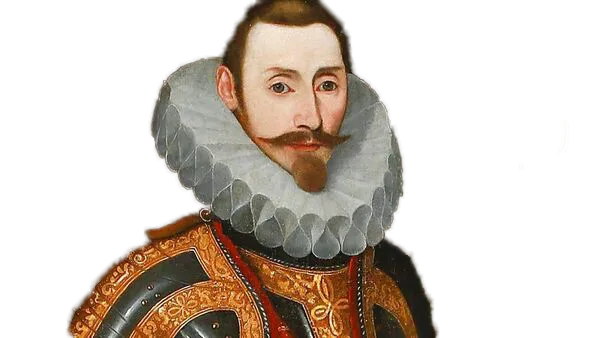
It follows the legendary fourteen-day march taken by Dónal Cam O’Sullivan Beare and his one thousand supporters in 1603, and it visits many of the places and communities shaped by their story.
The Way runs almost the length of the country and takes the walker and cyclist to some of its most beautiful and least explored areas in Ireland.
Journey along the coast of the Beara Peninsula, across six mountain ranges, along the banks of the River Shannon and through the lake regions of Roscommon and Leitrim as you travel the Beara Breifne-Way and collect the stamps to fill the Way’s ‘passport’.
Beara Way
The Beara Way is a looped walk around the Beara Peninsula, with the Ireland Way covering the southern section. The starting point is Castletownbere, a small fishing village with accommodation, shops, and restaurants serving locally caught seafood. The route takes you through the Caha Mountains, around Hungry Hill, and past Lough Toberavanaha, offering stunning views of Bantry Bay.
Castletownbere to Kealkill.
Distance: 57.5km.
Days: 3.
County: Cork.
More Information: www.theirelandway.ie/bearaway
Slí Gaeltacht Mhuscraí
Discover the majestic Slí Gaeltacht Mhuscraí, a breathtaking walking path in the heart of the western region of County Cork. Get lost in the stunning views of the Sheehy Mountains and Gougane Barra lake while exploring the diverse terrain of forests, moorland, and bogland. With every step, you'll be enchanted by the picturesque sights of mountains and lakes that will leave you in awe.
Kealkill to Millstreet.
Distance: 71.6km.
Days: 3.
County: Cork.
More Information: www.theirelandway.ie/sligaeltachtmhuscrai
North West Cork Way
Embark on an epic adventure along the North West Cork Way, known as the 'Beara-Breifne Way (Duhallow)'. This incredible route will take you on a journey from Millstreet to Churchtown, where you'll cross the historic river Blackwater, famously traversed by Donal Cam O'Sullivan Bere in the winter of 1603. Don't confuse this with the Duhallow Way - this is a unique and unforgettable experience that you won't want to miss!
Millstreet to John's Bridge.
Distance: 40.2 km.
Days: 2.
County: Cork.
More Information: www.theirelandway.ie/northwastcorkway

Ballyhoura Way
Discover the magnificent 13th Century Anglo-Norman fortress, Liscarroll Castle, nestled in the charming town of Liscarroll. Just a hop, skip, and a jump from the castle lies the Donkey Sanctuary.
Take a breathtaking journey between Galbally and Tipperary town and ascend Slievenamuck. Here, you'll be rewarded with a forest trail boasting awe-inspiring views of the Glen of Aherlow and the Galtee Mountains. Don't miss the Christ the King statue standing tall and proud, overlooking the valley. And, if you're feeling adventurous, venture over to Aherlow House Hotel to discover an ancient ogham stone!
John's Bridge to Tipperary
Distance: 87.2 km.
Days: 4.
Counties: Cork, Limerick, Tipperary
More Information: www.visitballyhoura.com
Multeen Way
The Multeen Way hiking trail is short. It's the third shortest stage on the Beara-Breifne Way. On the way, you'll see Donohill Motte which was raided by Donal Cam O'Sullivan Bere and his men for food. They also drank from the nearby Holy Well of St. James. The trail is mostly on the road until just past Donohill. Afterward, you'll walk on grass track and fields for the rest of the way.
Tipperary to Milestone.
Distance: 35.5 km.
Days: 1.
County: Tipperary.
More Information: www.sportsireland.ie
Ormond Way
The Ormond Way is finally complete on the Beara-Breifne trail! And if you're looking for a highlight along the way, look no further than the Cloughjordan eco-village. Feast your eyes on the solar-panelled buildings and lush vegetable gardens that provide residents with their own food. For a top-notch stay, try out Djangos Eco Hostel, which is nestled right in the heart of the eco-village. Don't miss out on this eco-friendly adventure!
Milestone to Lorrha.
Distance: 70 km.
Days: 2-3.
Counties: Tipperary.
More Information: www.intipperary.ie
Hymany Way
Embark on an unforgettable adventure along the Hymany Way, the longest stage on the Ireland Way spanning over 100km. Traverse through the picturesque County Galway, following the meandering River Shannon and uncovering hidden gems along the way. Marvel at the ancient Meelick Church, the oldest church in Ireland still in use to this day. Don't forget to stop and admire the stunning Brackloon Castle and the intricately carved doorway of the Clonfert Cathedral. This off-road trail promises to be an experience like no other.
Portumna to Ballygar.
Distance: 100.4 km.
Days: 4.
County: Galway.
More Information: www.galwaytourism.ie
Suck Valley Way
Step onto the well-marked Suck Valley Way and experience the rugged beauty of Ireland's western side. But beware, this boggy trail requires sturdy boots and poles, especially during the wetter months (which, let's face it, is most of the year!). And while there may be a shortage of accommodation along the way, the stunning scenery is sure to make up for it. Plus, if you're feeling extra adventurous, why not try the looped Ireland Way trail for an added challenge?
Ballygar to Loughglynn.
Distance: 66.5 km.
Days: 3.
County: Galway, Roscommon.
More Information: www.discoversuckvalleyway.ie
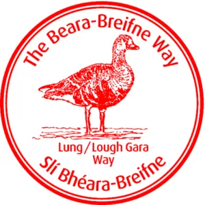
Lung / Lough Gara Way
The Lung/Lough Gara Way is a lengthy walking trail that has significant historical and archaeological importance. It commences from Clonalis Woodland in Castlerea, and passes through calm local roads, fields, and wetlands, eventually connecting with the Miners Way.
Loughglynn to Castlebaldwin.
Distance: 44.6 km.
Days: 2.
County: Roscommon.
More Information: www.visitroscommon.ie
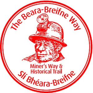
The Miners Way
The Miners Way and Historical Trail is a marked network of routes that pass through the scenic hills and valleys of Counties Sligo, Leitrim, Roscommon.
The Miners Way and Historical Trails in Arigna allow visitors to follow the routes used by miners and explore the surrounding mountains, including notable landmarks such as the Carrowkeel megalithic complex.
The total length of the two routes is 118 kilometers, and they can be completed by walking in two sections.
Ballinafad to Leitrim Town.
Distance: 54.4 km.
Days: 2.
Counties: Sligo, Roscommon, Leitrim.
More Information: www.leitrimtourism.ie
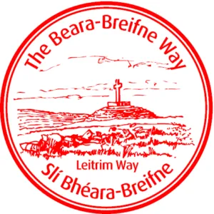
Leitrim Way
The Leitrim Way is a 56km walk connecting Manorhamilton to Leitrim Village. Typically, hikers traverse the route in 2-3 days, encountering diverse landscapes characteristic of this region in the northwest of Ireland.
The route begins in Manorhamilton, located in Leitrim's Five Glens. It proceeds southward, ascending rapidly from the valley to the summit of the Boleybrack Mountain range. The highest point of the journey is marked by the isolated mountaintop lake of Doolough.
Leitrim Town to Dowra.
Distance: 25.7 km.
Days: 1.
Counties: Leitrim, Cavan.
More Information: www.leitrimtourism.ie
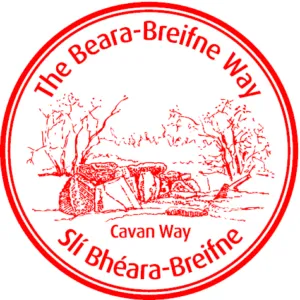
The Cavan Way
The Cavan Way is a 26 km walking route that starts in Dowra and goes north to the Shannon Pot, the source of the river. It then continues into the Cuilcagh mountains before descending to Blacklion. The route includes quiet roads, paths by the Shannon, and moorland.
Dowra to Blacklion.
Distance: 22.3 km.
Days: 1.
Counties: Cavan, Fermanagh.
More Information: www.sportireland.ie

© 2023 In Tipperary, All Rights Reserved.
Web Design by Pixelweb Design